
Trace an Alexandria Street by Address
An address search in Alexandria starts with the City assessment form, then moves through a parcel and a recorded instrument. That order prevents a common mistake: treating an owner mailing address as the physical address, or treating a visible map shape as a legal boundary. The City is an independent city, so city assessment and Circuit Court records are the normal starting points for property inside the municipal boundary. An Alexandria mailing address near the edge can instead belong to Fairfax County or Arlington County, which requires the records of that locality.
Use the street spelling supplied by the City. Directional words and suffixes matter on streets such as North or South Washington and East or West Braddock. A unit matters too. The public card may identify an owner or tax correspondence address, but it does not furnish a roster of everyone who occupies a home. For historical work, a criss-cross directory and census record can add household evidence after the parcel has been identified.
- Open the City assessment address form and enter the street name. Leave Street Number and the unit field blank to browse the listed properties on one street, or add both to narrow a single address.
- Open Property Details. Save the situs address, account number, map-block-lot number, owner name, mailing address, and legal description as separate facts.
- Use Parcel Viewer to compare the selected polygon with adjoining parcels, zoning, and mapped subdivision plats. The map is a locator, not title evidence.
- Search the Alexandria Clerk's grantor-grantee index with the owner and legal description. Read the latest deed before moving to the seller's earlier purchase.
- For a past household, compare a dated criss-cross directory entry with a census and the deed sequence. The historical collections are described in the Alexandria city directory resource.
Note: Keep the official spelling, unit, map-block-lot, and legal description together, because a street number can identify several condominium, rear-lot, or consolidated-parcel records.
Alexandria Street Directory Search Fields
The Alexandria Real Estate Assessment Search has an address path rather than a public owner-name field. Street Name is required. Street Number and Apt No., Condo Unit No. or Letter are optional, which is why the form can serve both a single-address check and a whole-street browse. Account Number and Map Number are separate search modes. Results link to property details, sales information, tax and fee material, and the Parcel Viewer.
| Form field | Entry type | Required? | Alexandria use |
|---|---|---|---|
| Street Number | Text, up to 25 characters | No | Leave blank to see the selected street's property results. |
| Street Name | Autocomplete text or official list | Yes | Select the normalized name, including a directional prefix or suffix. |
| Apt No., Condo Unit No. or Letter | Text, up to 25 characters | No | Use it to separate a unit from a multiunit parcel. |
| Account Number | Separate search mode | Alternative | Find a known assessment account directly. |
| Map Number | Separate search mode | Alternative | Find a known map-block-lot identifier. |
A screenshot of the official address-search form shows the fields used for Alexandria street directory work.
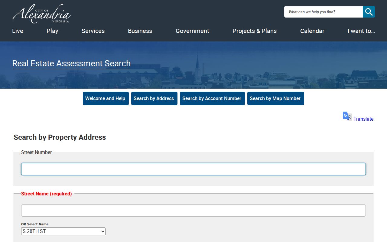
After a result opens, record the exact returned address before switching to account or map-number searches. That check makes later deed and map comparisons more reliable.
Read Alexandria Parcel Identity
Each assessment card separates the address where a building sits from the address where the owner receives tax correspondence. The card also carries an account number, map-block-lot number, legal description, assessment values, tax status, building information, and sale references. The inspected City Hall card illustrates the distinction: its situs is 301 King Street while its mailing address is a post-office box. That makes the owner and mailing fields useful research clues, but neither proves who is currently living at the location.
- Parcel
- A defined piece of land or property unit used in the assessment and mapping systems. One street number can relate to more than one parcel.
- Situs address
- The physical place where the parcel or building sits. It is different from the owner mailing address on a tax card.
- Plat
- A recorded map of lots, blocks, or divisions. It can connect a deed description to a parcel, but a map-viewer outline is not title evidence.
- Criss-cross directory
- A historical address section that can identify a printed occupant, owner, or business for that particular edition.
For a street directory search, the legal description and map-block-lot are the durable bridge when a number has changed, a lot has been combined, or several units share an address. Keep them with the record date.
Use the Alexandria Parcel Viewer
The City of Alexandria Parcel Viewer lets a researcher locate an address or parcel, select its polygon, pan along a street, and open linked assessment details. It can display zoning and geographically linked subdivision plats or survey plans dating to the 1950s. Those layers help separate adjoining lots, common areas, rear parcels, and public rights-of-way that may look like one block from the street.
Use the Viewer after identifying a property card, not as the sole proof of a parcel boundary. The City's interactive-map notice says the maps are informational, are not survey quality, and are not official boundary or title evidence. A recorded deed or plat from the Clerk remains the proper source when the legal parcel line matters. Print tools may help a research note, but retain the map date and layer used.
Alexandria Street Records Compared
Different address-keyed records answer different questions. The assessment system is the practical street-wide starting point. The Clerk's land records establish recorded transfers, while APEX contributes a dated building or code trail. A historical directory can place a named household or business at an address in one edition, but it does not replace the current parcel record. This division of labor keeps an Alexandria street directory search grounded in the record that supports the claim.
| Address source | Alexandria keeper | Street-level result | Access route |
|---|---|---|---|
| Assessment address search | Office of Real Estate Assessments | Owner, mailing and situs addresses, account, map-block-lot, values, and sales links | Free address, account, or map search; office appointments are available. |
| Parcel Viewer | City GIS | Parcel polygon, linked assessment details, zoning, nearby lots, and mapped plats | Free interactive map; informational only. |
| Recorded deeds and plats | Alexandria Clerk of Circuit Court | Grantor, grantee, legal description, recording date, book or document reference | COVERS/SRA, public records room, printed indexes, books, and microfilm. |
| APEX permits and code cases | City permit and code services | Project address, public plan or permit status, inspection history, and work description | Active public data online; older material through Library, Archives, or FOIA. |
| Criss-cross directories | Alexandria Library and Archives | Past address-to-occupant, owner, or business clues | Reference collections; the address section is confirmed from 1924 onward. |
The voter-status portal does not fill a missing row in this table. It is an individual self-service status and polling-place tool, not a public street roster. Virginia law restricts VERIS records and voter-list access under Va. Code §§24.2-404 through 24.2-407.
Note: Use the assessment, map, and deed identifiers as a chain, then treat every directory, permit, or election record as evidence with its own date and limits.
Follow Alexandria Deed Records
Once an assessment card supplies the current owner and legal description, the Alexandria Clerk of Circuit Court Land Records page points to COVERS and Virginia Secure Remote Access, often called SRA. Locate the current owner as grantee, read the instrument's grantor, recording date, deed type, legal description, and any prior-instrument reference. Then search the seller as a grantee to find that person's earlier acquisition. The pattern is grantee to grantor, then that grantor as an earlier grantee.
The street number is only a lead. Legal-description wording, lot and block references, a subdivision name, and a map number can connect a deed to a parcel despite renumbering or consolidation. SRA image access can require clerk-authorized subscription access, so an index result may need a counter visit or copy request. The Clerk lists copies at $0.50 per page and certification at $2.
For a current owner, the Clerk's VADeed Alert offers free email notices when a deed, mortgage, deed of gift, or similar recorded document matches a name or tax map/parcel ID. The 2026 service allows multiple name variants and parcel IDs. It is a property-fraud alert, not a source for identifying occupants along a street.
An official Clerk land-records page provides the access and copy details for the next step in the street directory trail.
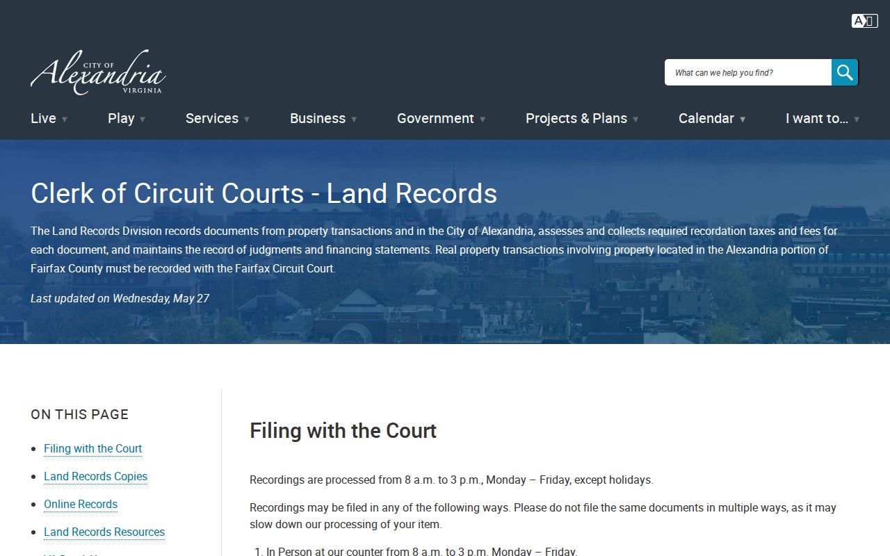
The online and counter routes matter because a search result is an index entry, while the recorded instrument supplies fuller parcel and transfer context.
Bridge Alexandria's Deed Gap
Alexandria's online deed coverage is segmented, not a continuous historical run. COVERS lists deeds and land records online for 1785 to 1801, 1821 to 1824, and 1930 to the present. Physical printed indexes, books, and microfilm at the Clerk span December 1782 through October 1993. A missing online hit from the nineteenth century or early twentieth century therefore calls for the physical bridge, not a conclusion that no transfer occurred.
The practical fallback is the Clerk's public records room at 520 King Street, Alexandria Library Special Collections, and the FamilySearch Alexandria/Arlington land catalog. That catalog identifies deed books from 1801 to 1901 and general indexes from 1799 to 1920 on 22 reels. A researcher may use the counter, request copies, or use the Clerk's mail channel for land-record material when online access is insufficient. Keep the historic Alexandria City, Alexandria County, and Arlington jurisdiction labels in view.
Alexandria Address Permits and Plans
APEX adds a date layer to an Alexandria address. Public access covers active plans, permits, and code cases without signing in. The system may show a permit number, project address, plan status, inspection history, work description, and public attachments. Applicant eReview remains restricted, so the public result is not a complete applicant file. A permit applicant or contractor is a project clue, not proof of residence or ownership.
Older permit sources deepen the street trail. Alexandria Library's house-history guidance identifies 1890s to 1920s permit material indexed by address and owner. The Alexandria Archives & Records Center lists new-construction permits from 1930 to 1960 and alteration permits from 1930 to 1950. Visits are appointment-only and document requests currently route through the City's FOIA process. These channels can show when a structure or addition existed between deeds and directory entries.
Note: Permit evidence dates work at a location, but the recorded land instrument is the better source for a change in legal ownership.
Translate Alexandria Street Numbers
Street-by-street research in Alexandria often reaches the 1887 renumbering. The City-hosted Alexandria Chronicle material describes a campaign that assigned sequential hundred-ranges by block. An old directory or atlas may have an approximate description, an earlier number, or no number at all. The 1877 Hopkins Atlas, 1885 and 1891 Sanborn maps, a legal description, and the criss-cross section are the local bridge from that record to a modern search field.
The street name may need translation as well. A 1953 naming plan formalized names and old/new variants effective July 1, 1953. Preserve directional prefixes and both historical and current spellings in research notes. Annexations in 1915, 1930, 1951, 1966, and 1973 also changed locality labels found in older records. In particular, the 1930 absorption of the Town of Potomac links Del Ray and St. Elmo records to modern Alexandria.
Limits of an Alexandria Street Directory
An Alexandria street directory can document a parcel owner, owner mailing address, recorded transfer, public permit, or historical directory entry. It cannot supply every person living along a street. Current non-owner occupants, household members, utility customers, and DMV address data are not part of the public property roll. A blank, post-office box, or missing voter entry is not an invitation to infer a protected address or fill it from another source.
The Virginia voter portal is limited to an individual's own registration status and polling place. Someone checking their own registration can also contact Alexandria Elections at 703-746-4050. Registered-voter lists have defined statutory recipients and purposes, and are not a substitute for a street roster. Virginia's Address Confidentiality Program also protects eligible participants through a substitute-address and mail-forwarding program. Respecting those boundaries is part of accurate address research.
Lawful use. Alexandria address records support personal research, family history, property questions, and civic understanding. Never use an address trail to stalk, harass, intimidate, or harm another person.